The United States is sinking, well more accurately just the East Coast.
Should those of us living on the East Coast (the right coast IMO) be worried?
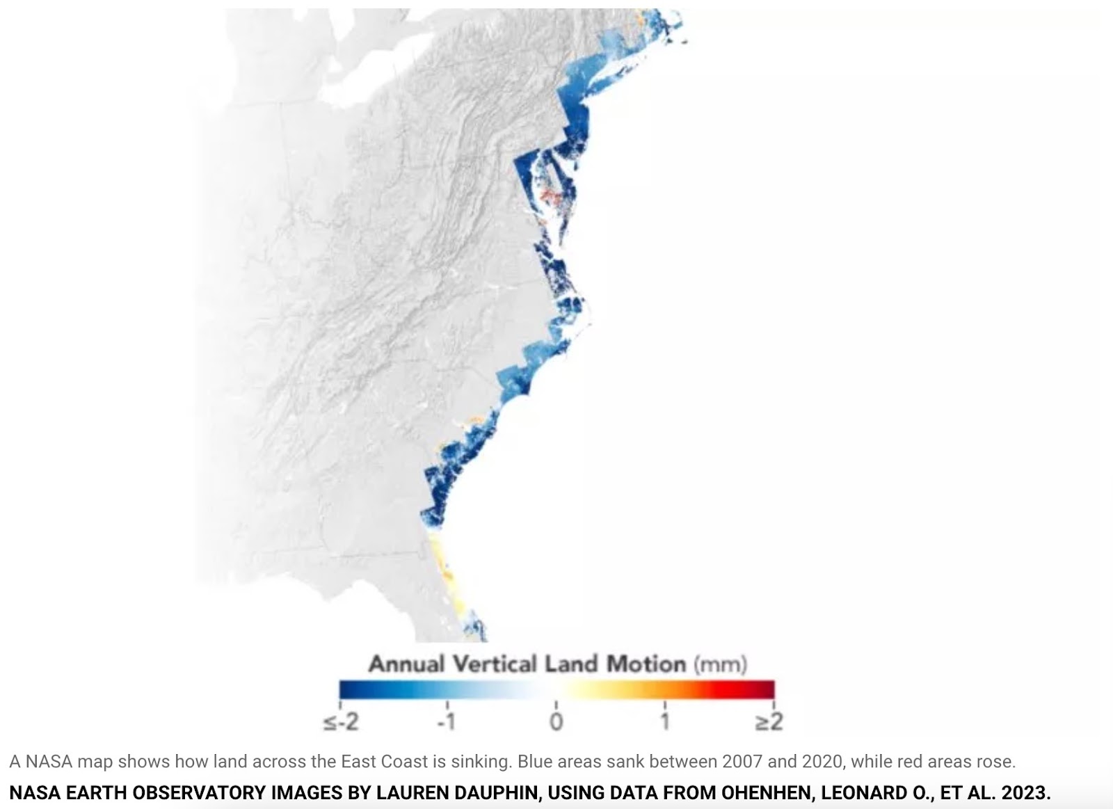
Probably not, unless you can detect the earth subsiding by 1 to 2 millimeters each year.
A team funded by NASA at the “Virginia Tech’s Earth Observation and Innovation (EOI) Lab found that the land under major cities including New York, Baltimore, and Norfolk, Virginia sank by 1 to 2 millimeters each year between 2007 and 2020.” according to a report in Newsweek.
According to Leonard Ohenhen, a Ph.D. student at Virginia Tech and one of the paper’s authors said that “between 2,000 to 74,000 square kilometers of land area, which is home to 1.2 to 14 million people and 476,000 to 6.3 million properties, are sinking at a rate of 1 to 2 millimeters per year.” and that “This sinking land affects more than half of the infrastructure in several major cities, putting them at an increased risk of flooding and other coastal hazards,” he said.
For context, 1 millimeter is equal to 0.0393701 inches, so yea, I’m not stressing this news very much.
But if you extrapolate that over the next 100 years that means the East Coast of the United States could shrink by between 3.9 – 7.87 inches. That would be enough for me to worry, if I thought I’d live another 100 years.